
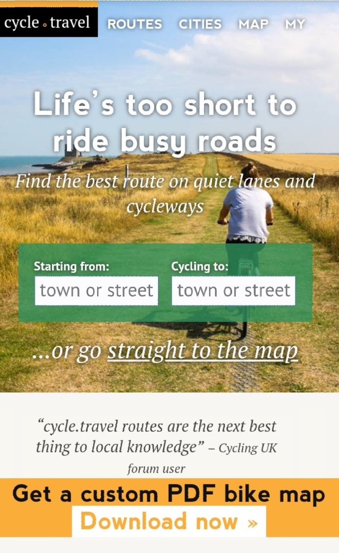
cycle.travel
Cycle.Travel is our go route planner to help us plan day trips and a longer tours.
We find cycle.travel is easy to use, with several useful tools and features and can be trusted to find you a quiet route on cycle paths and minor roads, so you can concentrate on enjoying the ride.
cycle. travel is
free or paid subscription, via Patreon, which gives you access to more maps, satellite and weather information.
For this review I have used the paid subscription level, shown by coffee cup.
Release of Android app 07 August 2023
This has now been released and is now in open testing before release to all at the end of August for more information can be found here
Release of iPhone app 23 January 2023
cycle.travel released it's app at the end of 2022 for iPhones, which compliments the website. The new app allows you to plan and navigate on the move, with turn by turn navigation, accommodation search, offline maps. The app is free to download and use.
If you chose their is an option to become a supporter with a monthly donation via Patreon which will give you access to more features including
- Extra clear Wayfarer map style, with strong colours for roads and paths
- Map library with maps including Ordnance Survey, IGN France, and OpenCycleMap
- Contours and hill-shading on the map
- Sketch mode – draw your route in seconds by just dragging your finger
- Find points of interest – look for cafes, pubs, bike shops, toilets, drinking water and more (and it works offline!)
- Icons you can tap – tap symbols on the map for more details
For Android users cycle.travel plans a release in 2023.
At this time I can not do a full review, that will have to wait until the Android version is released.
How to use the app basics info taken from website.
Across the bottom of the app screen, you’ll see a set of buttons. Click the Settings icon at the right. You’ll see Help in the menu that appears. This is your quick-start guide to the essential features.
This manual, here on the cycle.travel website, goes into more detail. Click the section headings near the top of the page to browse the pages.
Any essential tips?
The bottom panel can be dragged up and down. Drag it up to see buttons and the elevation graph. Drag it down to leave more space for the map.
The speedometer doubles as your pause/stop button! Tap it to pause a ride. Your ride will resume when you restart. Tap it again to stop, and clear the route.
The arrow button on the map gets you back to your current location if you’ve panned away.
You can find more information on the website
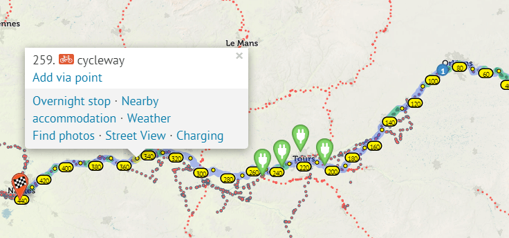
New Feature - charging points
When planning your route with an electric bicycle cycle.travel have added a useful feature that shows where charging points are located.
Once you have planned your route click on it, a pop up box will appear, click on "charging and locations will be shown.
Route Planning.
For us a hour in the evening planning the next day's route is time well spent, because we are not fans of just heading off and ending up down some dirt track that has wheel sized holes which our bikes disappear in, then a climb up a bolder covered path.
cycle.travel gives you the option of planning on you phone, tablet or computer. To set the route you can either enter the start / finish location in the boxes, or go straight to the map and click or tap your start and finish points. The app will then plan your cycle friendly route.
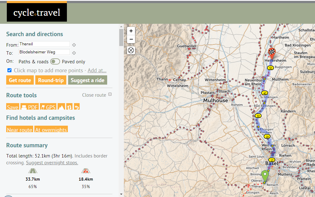
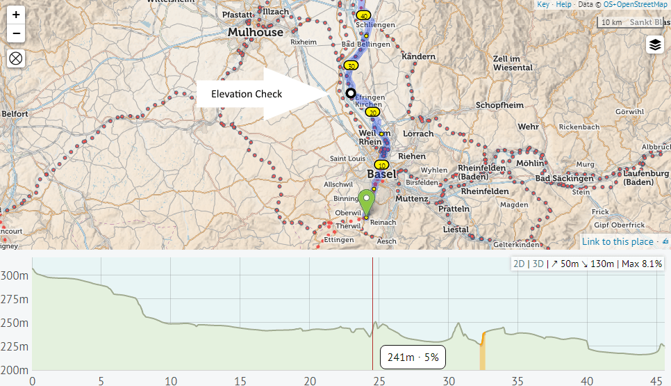
Once the route is formatted you can check the elevation and accommodation by clicking on the buttons. There is a turn by turn guide and our favorite part is a detailed break down of the route surfaces in the summary.
If you want to make detour or change of route on the desk top version hover over the route and a white dot will appear, then drag the white dot to create a new route. Tapping the route on the phone app will give you a way point which you can then drag to change your route.
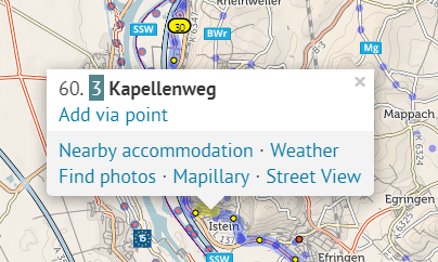
Right clicking on the route gives you several options for adding information or discovering the local area and accommodation.
Cycle.travel will suggest local routes and plans round-trips, which you can split into several days using the overnight symbol .
Another tool “Suggest overnight stops” will help to plan daily ride distances with accommodation. More can be found about this
here.
Once your route is planned you can visit the forum and city guides for more information. When you route is complete you then have a choice of printing a PDF or downloading a GPS file for your navigation device. So all is ready and you can discover the world with 2 wheels......
Points of Interest
I have used cycle.travel as my main route planning tool, as a quick way of finding local cycleways, voie vert and quiet routes, before uploading to Kamoot for navigation.
Pro's
- Now available as an app for iPhones
- Its Free, I would recommend paid version with satilite and extra maps, via Patreon for 2 USD plus VAT a month, it is fantastic value.
- cycle.travel map shows all international, national and local cycle routes.
- Route summary breaks down the route surfaces which helps you plan routes to yours and the bike's capabilities. No surprises.
Con's
- There is not worldwide coverage at this time, but new regions are being added.
- If you click on the back button when in map mode it deletes all information and resets the page.
- Information about the new app is limited on the website.
If you have found this useful please consider
buying me a coffee. A coffee helps turn the wheels!
You can find links to all our social media via Linktree
Copyright © 2024 Jenni and Martin Clarke. All Rights Reserved